Space of Remembrance

Topography of KL Lublin and the Grounds of the State Museum at Majdanek

Watercolor, wooden barrack in the shape of the letter F in the foreground
The exhibition presents changes that occurred on the grounds of at the Majdanek German concentration camp in Majdanek in 1941-1944, as well as the transformation of the museum grounds into a memorial site with various forms of commemoration. Almost 80 years after the decommissioning of the camp, the research into its topography is still ongoing. Archival sources often contain contradictory or imprecise information, and field verification of the analysis results is not entirely possible, as a significant part of the former camp site area has been swallowed up by the expanding city.

Important information

Temporary exhibitionArchival
  • Exhibition start date:10.08.2021
  • Place:State Museum at Majdanek
  • Translation:Witold Wojtaszko
  • Scenario:Krzysztof A. Tarkowski, Lech Remiszewski
  • Language version:Polish, English
  • Artistic design:Izabela Tomasiewicz
A black-and-white historical photograph showing a construction site; in the center are three men, one of whom is digging in the ground with a shovel; in the background on the left is a building, with trees behind it

Maps as the Key to Understanding Spatial Changes

The plans and maps in the museum's collection, both those drawn up by the Germans during the construction of KL Lublin and those related to the museum's post-war activities, present the transformations in the topography of Majdanek from the beginning of the camp's existence, through its transformations and liquidation, to the present day. This helps to understand why part of the historical building fabric was destroyed and which elements of it have been preserved in the spatial layout of the memorial site.

Drawing of a concentration camp plan in the shape of a trapezoid, 10 designated halves with double rows of rectangles, on the left a handwritten inscription in German (illegible).
Camp construction plan from October 1941.
Historical map - camp site plan
1942 Majdanek general construction plan that assumed the creation of a camp for 150,000 prisoners.

KL Lublin

In the autumn of 1941, in the eastern suburbs of occupied Lublin, the Germans began the construction of a concentration camp. The plan from October 1941 envisaged dividing it into 10 prisoner fields with a total area of 60 hectares and building 236 barracks. Elements of this plan include five fields that have been preserved to this day. The general construction plan of 18 February 1942 envisaged the creation of a camp complex for 150,000 prisoners. Growing difficulties with raw materials and transport related to the Eastern Front forced a reduction of the project. As a result of the works conducted between the turn of 1941/1942 and the spring of 1943, the following were built: the SS sector, the economic complex and the prisoner camp consisting of five fields. Throughout its existence, until its final liquidation on 22 July 1944, the camp underwent systematic expansion and planning changes, which were closely connected to the economic, extermination and military policies of Nazi Germany in the occupied Lublin region.

A group of several people dressed in striped uniforms and work clothes, holding shovels, standing around a pile of earth.
Prisoners during construction works of Berlinerstrasse, as the Majdanek's main road was called in the camp jargon.
Watercolor, rows of barracks, with the crematorium in the foreground

Before the Museum

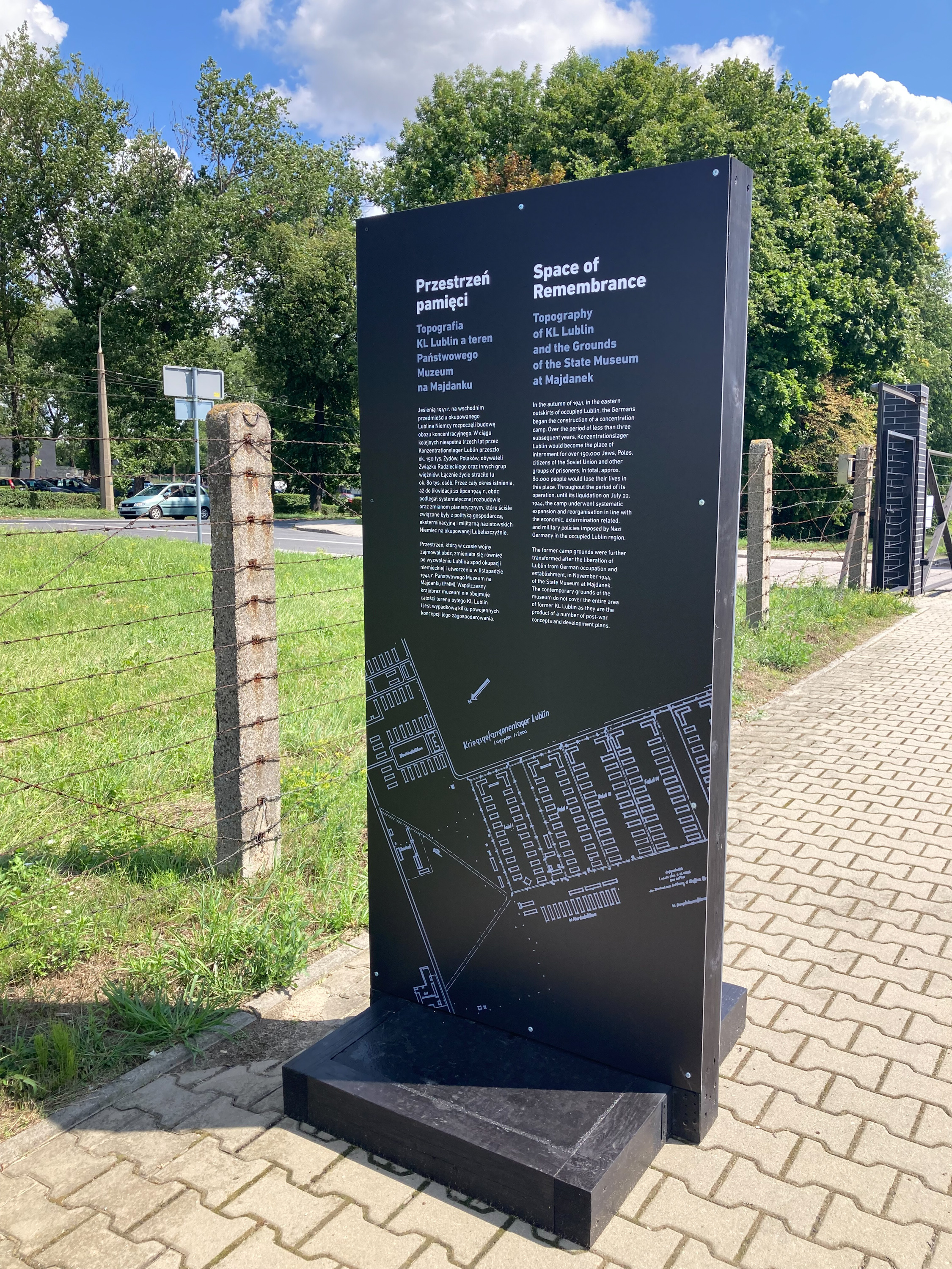
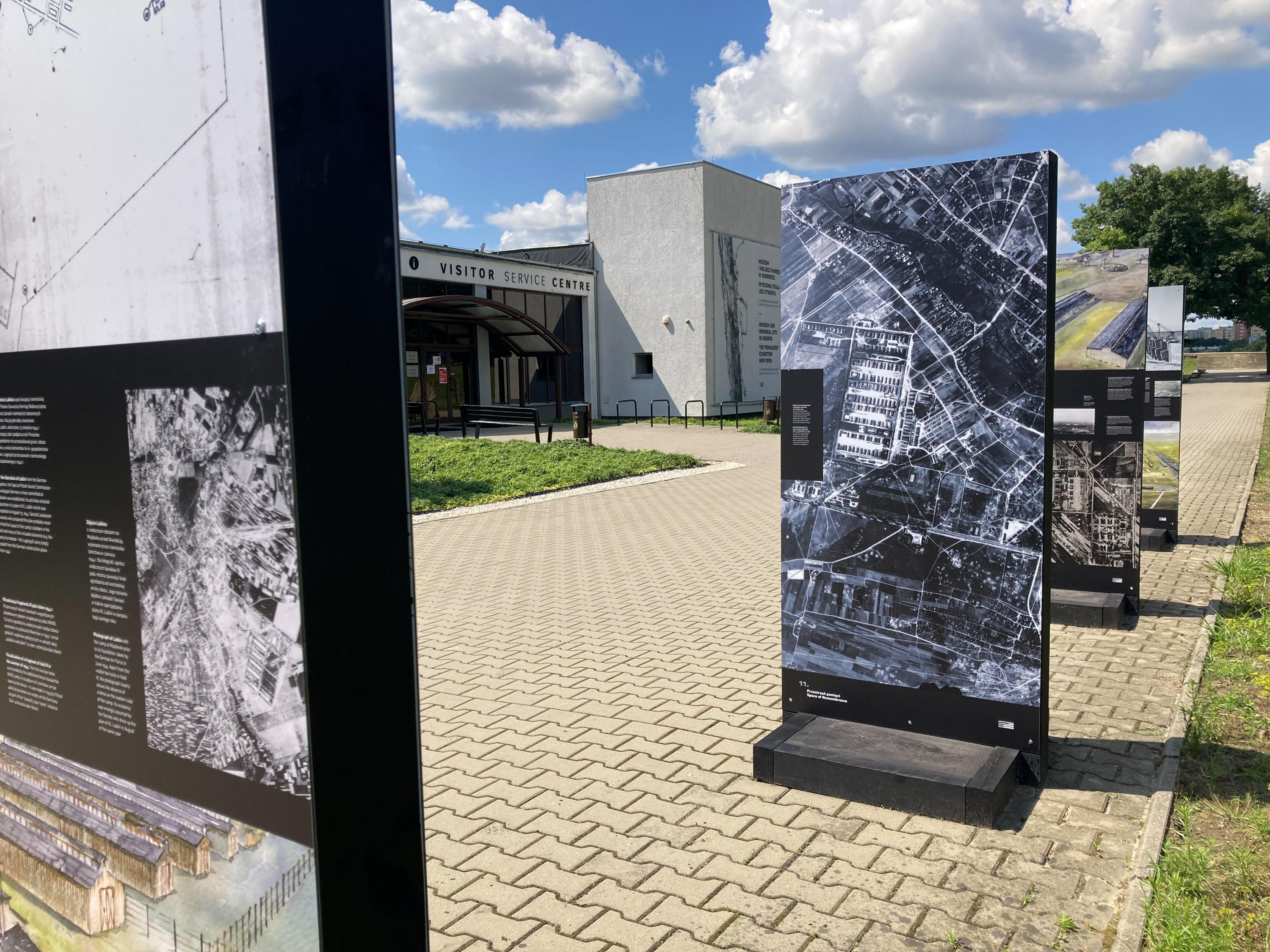
The space occupied by the camp during the war also changed after the evacuation of the SS personnel and the liberation of Lublin from German occupation. From the summer of 1944 to the summer of 1946, units of the Polish People's Army were stationed in the prisoner field I. At the beginning of August 1944, the Soviets established an NKVD filtration camp on the former field III, where they detained the compromised Home Army and Peasant Battalions soldiers. After several weeks of internment at Majdanek, most of them were transported deep into the Soviet Union. In November 1944, the State Museum at Majdanek began its activity. The contemporary landscape of the Museum does not cover the entire area of the former KL Lublin and is the result of several post-war concepts for its development. According to the first plan from 1948, the prisoner field III was to serve as a place of remembrance of nations, while the damaged barracks in the other fields were demolished. Fields I, II, IV and part of V were reforested, creating the Forest of Remembrance. The 1961 land development plan involved the removal of trees that adversely affected the historical landscape. In their place, the outlines of the barracks were recreated. In 1976, construction of a municipal cemetery began on the farmland adjacent to the Museum on the eastern side.

A group of men dressed in civilian clothes, in the front row a man wearing a forage cap and an eagle
Home Army soldiers at Majdanek, August 1944.

Iconography

The exhibition featured reproductions of plans, maps, historical photographs, including aerial photographs, as well as contemporary photographs taken from a drone. However, the most interesting piece of the exhibition were 14 sketches coloured with watercolours, showing the area of KL Lublin and the post-camp landscape, based on computer visualisations of the area.

Map, drawing, plan of the concentration camp and adjacent fields.
1943 plan of Majdanek created by the in-camp resistance.
Watercolor; on the left and right, gaps separated by a road; view from above